UN
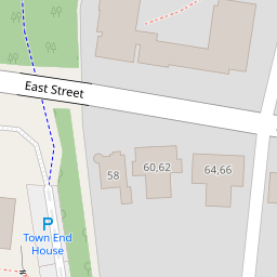
66 East Street
£ 450,000
Description
We don't have a Description for this property.
- Bedrooms
- 5
- Bathrooms
- 0

Leaflet © OpenStreetMap contributors
The heatmap indicates the level of crime in the area. The color of the heatmap indicates the crime severity and recency.
Metrics Year-on-Year
- Average area value
- 354,000.00 £Decreased by 21.23 %
- Average area rental value
- 1,321.00 £/moIncreased by 24.62 %
- Est rental Yield
- 4.48 %Increased by 58.30 %
- Crime Rate
- 3.00 %Unchanged by 0.00 %
from 449,421.00 £
from 1,060.00 £/mo
from 2.83 %
from 3.00 %
Nearby Schools
| Name | Type | Ofsted | Distance |
|---|---|---|---|
| Fairfield Infant School | Community School | Good | 0.33 KM |
| Bosmere Junior School | Community School | Good | 0.66 KM |
| Warblington School | Community School | Good | 0.91 KM |
| St Alban'S Church Of England Aided Primary School | Voluntary Aided School | Good | 1.37 KM |
| Trosnant Junior School | Community School | Good | 1.53 KM |
Images
Nearby Streets
| Name | Average Price | Average Sqft | Distance |
|---|---|---|---|
| Prince George Street | £ 0 | 0 | 0.00 KM |
| Park Road South | £ 120,000 | 0 | 0.00 KM |
| A27 | £ 385,000 | 0 | 0.00 KM |
| Petersfield Road | £ 0 | 0 | 0.00 KM |
| The Mallards | £ 0 | 0 | 0.00 KM |
Nearby Transport
| Name | NLC | TLC | Distance |
|---|---|---|---|
| Havant | 5532 | HAV | 0.67 KM |
| Warblington | 5264 | WBL | 1.14 KM |
| Bedhampton | 5538 | BDH | 2.12 KM |
| Emsworth | 5257 | EMS | 4.27 KM |
| Rowlands Castle | 5658 | RLN | 5.12 KM |
Nearby Listings
| Address | Price | Type | Score | Distance |
|---|---|---|---|---|
| East Street, Havant, Hampshire | £ 70,000 | BUY | 5 / 10 | 0.06 KM |
| Lymbourn Road, Havant | £ 345,000 | BUY | 8 / 10 | 0.06 KM |
| Bellair Road, Havant | £ 157,000 | BUY | Unknown | 0.14 KM |
| Lymbourn Road, Havant, Hampshire, PO9 | £ 360,000 | BUY | 6 / 10 | 0.14 KM |
| Bellair Rd, Havant PO9 | £ 699,995 | BUY | Unknown | 0.17 KM |
Nearby Properties
| Address | Price | Distance |
|---|---|---|
| 66 East Street | £ 450,000 | 0.00 KM |
| 22 Lymbourn Road | £ 246,500 | 0.09 KM |
| 23 Lymbourn Road | £ 200,000 | 0.09 KM |
| 25 Lymbourn Road | £ 92,000 | 0.09 KM |
| 26 Lymbourn Road | £ 220,000 | 0.09 KM |